Saturday, July 7, 2012

Storm Point - Guide's Wall

     Yesterday, I completed the Guide's Wall route on Storm Point in Cascade Canyon with my friend Kevin. If you have been following along, I had been eyeballing this route earlier in the season in hopes of bagging it. Yesterday, we got an early start and took the first boat across Jenny Lake to begin our hike into Cascade Canyon. The weather was very foggy in the morning from the last day's rains, but the day promised to be warm and sunny. Conditions were perfect for a long day's climb.
      Remember, Guide's Wall is a mega classic, six pitch, alpine grade II rock climb rated at 5.8 difficulty. Follow the pictures to see our climb.

starting up the talus field to get to the climb
the guide's wall route follows the orange lines approximately
one bails from the top by four rapells from the top star to get back to the start

me and Kevin at the top of pitch 4, getting ready to begin the
 handcrack variation pitch

from near the top of pitch six, I stopped on lead to snap a couple photos
this photo gives you a good idea of the exposure

a photo of Mt. Owen - 12,925 ft. from near the top of pitch six
     The climb was a spectacular success! We were first party on the wall, and encountered only one party below us. Weather was perfect and the climbing was excellent, especially the hand crack variation on pitch five, and pitch six at the top. Upon repelling back to the bottom, we looked forward to the boat ride back across Jenny Lake to follow our hike out. My kind of mechanized climbing!


Thursday, June 14, 2012

Snow Climbing to Lower Saddle

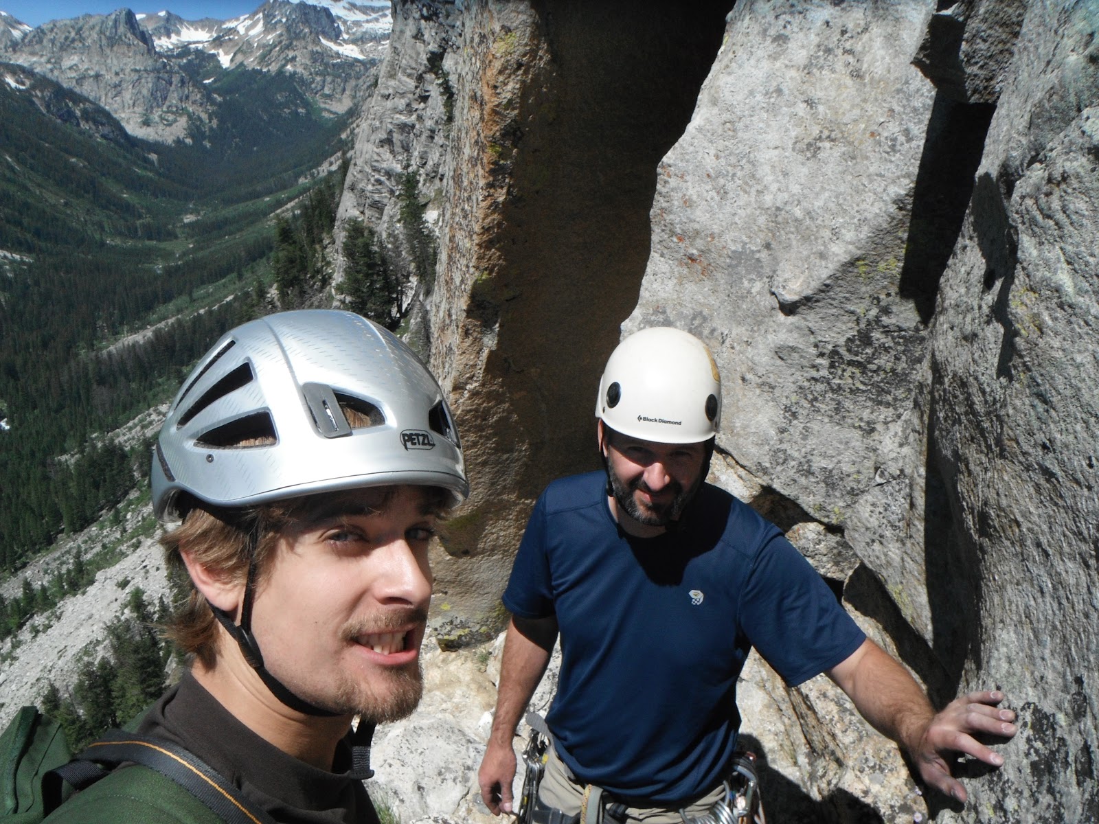
   Things have been busy here in Teton County. The summer season is beginning and work has been picking up for me. Earlier this week, I managed to find some time to go exploring. As mentioned in my previous post, I have been trying to get a feel for the local terrain by scouting out some of the Teton Range's more notable locales. This week, I made it up to the famous 'Lower Saddle,' a feature which stretches between the Grand and Middle Teton. From the top, one can look down into Idaho to the west, and Wyoming to the east.

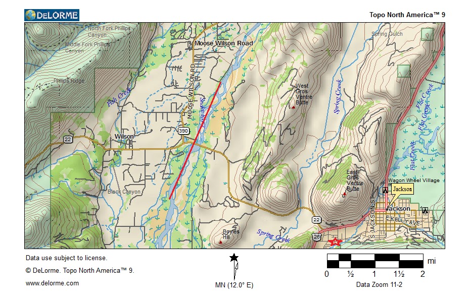
map of upper Garnet Canyon, my route to Lower Saddle is marked in red

   Among mountaineers, the Grand Teton is world famous. Dozens of routes criss-cross its myriad craggy faces. Notable rock climbs and more than a few desperate ice climbs ascend the massif from top to bottom. My goal for the day was to get up before dawn, and scramble my way up into Garnet Canyon to glimpse the Tetons in their full glory. From Garnet Canyon, I planned to ascent to the Lower Saddle, the launching point for a number of Grand Teton climbs, including Lower Exum Ridge, and the Owen-Spaulding route. My logic was that making it to this launching pad would give me a good idea of what it would take to do these and other famous climbs when I would later decide to tackle them.

view of the Grand Teton from near Lupine Meadows
   The hike into Garnet Canyon was beautiful in the pre-dawn light. Morning was beginning to creep into Jackson Hole, and mist and fog drifted among the myriad of trees and lakes along the hike. My kit was, as usual, light and minimal. Although the hike began on dry terrain, I was sure to bring along snow climbing gear, including my trusty ice ax and crampons, as I was sure to encounter vast snowfield in the high alpine terrain. As I crept way way up steady switchbacks, the trail eventually straightened due west, higher into the canyon, and toward my objective.


   It is always pleasing to encounter other climbers in the high mountains. Upon entering the snowfields below the Middle Teton, I encountered a few older climber packing up their bivouac from the previous night. Travelling from Dayton Ohio, they had endeavored to camp in the cirque for the previous night. The weather was anything from perfect the day before, but they wanted to see what 'bad' was like in the high mountains. Their spirits were positive, and the day was fine for their hike out, despite them having to camp much lower in the mountains than they had planned and getting pummeled by winds.


   My path headed northwest from their snowy campsite, and proceeded straight up the first of two steep snow headwalls to my final objective. Upon reaching the steep slope, I encountered two more fellow climbers, struggling their way up the incline with heavy packs and ski poles. They were kind and made small chit-chat as my pace passed theirs. They were also headed to the saddle, but it would take them some time more with all their gear. I felt for their backs and knees, but had little time to stop. Daylight was beginning to melt the snow, and good cramponing conditions necessitate solid snow for safety.

ascending the first snow headwall

   After passing the first headwall, I stopped to munch a meal bar and drink some water. Before me to the north was the Grand's imposing granitic spires, and to the south, Middle Teton Glacier stretched steeply to a stretch of granite just below the mountain's eastern summit. The weather was clear and sunny, although clouds were condensing above upon the Lower Saddle and blowing down in my direction. The sun was taking its tole upon Middle Teton's eastern facing slopes. Ice from our cool weather was quickly melting and rocks could be heard raining down like blowing balls from above. I was careful to stay away from it's precipitous slopes...

the Grand, as seen from SE

MiddleTeton, seen from NE

final headwall up to Lower Saddle, between the Middle and Grand

   One final snowy slope lay between me and my objective. The snow was solid enough for the steep ascent, and with no sign of weather coming in, I was eager to plod my way up. Ice ax in hand, I bootpacked my way up with hardly a stop. For most folks, the altitude begins to get them here, but having grown up in Colorado, I have found that I can stomp to about 12,000 ft or so before I really start to feel it. Ahead up the bootpack, two other climbers were ascending the slope, their final objective perhaps only known to them.

   The terrain on the Lower Saddle was rough, but there were signs of tundra life below the snow and ice. A sign could be seen instructing climbers to only camp in designated spots, so as to preserve this scant plant life. A large tent was also present upon the saddle, no doubt used as a way station for rescue teams or rangers who frequent the area in the summer season. For now, it was padlocked shut. Clouds continued to blow in from Idaho, as I gazed far below to those famous potato fields, obscuring the higher heights of the Grand from view. Wind howling, I snapped a few recon photos and prepared myself for my glissade down from the saddle. The snow was warming and if I wanted to make it down safely, I would have to do it quick. This area was famous for its wet slide avalanches in spring after a good snow.

ethereal view from Lower Saddle

me at the top, with trusty ice ax in hand!

   My crampons were stuffed back into my pack, and I donned my good alpine pants for the sledding down. The slope was precipitous and made for good sliding, although I found myself wishing I had brought a space blanket to make the going quicker. Having enjoyed my time in the canyon, I enjoyed the walk out and back down the canyon. I encountered a few other hikers far below on the snowfields and told them of the snow and sun above. Winter was still clinging in the high alpine for those eager to experience its good times before they melted away.

view of the grand, south face

   My trip was a success, and I snapped many good photos. These, combined with the experience, would provide me with good information for future ascents up the rock, snow or ice.

 More to follow....


   Champions of the Day - Honorable Mention

   Before sliding down to the lower snowfields, I heard to climbers shouting far above from within the Stettner's Coulior. These fellows were the champions of the day, ascending three or four pitches of steep, desperate water ice to gain the summit of the Grand. Here are some photos of these fellows to give you some scale. You can see how their route remains just barely out of the sun. Theirs truly was a race against time, as the condition of the mountain would deteriorate quickly once the sun hit. Keep on picking, noble climbers, and watch out for that rock fall!

ice climbers ascending Stettner's Couliour (i think?) they are marked with red circles
as you can see, the scale is quite large. click photo to zoom in

Wednesday, June 6, 2012

Teton Beginnings


   Greetings once again outdoor enthusiasts. I am reporting from my new home in Jackson, WY. Over the past few months, I have been frantically getting my ducks in a row for the move. Jackson is proving to be a veritable gold mine of outdoor objectives, and I have only begun to scratch the surface. This is my first post to report on some new projects, one familiar in style and one new.

   Upon arriving in Teton County a few weeks ago, I was eager to get the lay of the land. As I had done most of my climbing and hiking in the Colorado Rockies, understanding the new lay of the land would be my first goal in putting my skills to work. By going on a ranging run, I would be able to explore approaches to climbs that I had my eye on, and get a feel for things like snowpack, weather patters, rock quality and the severity of the climbing relative to what I know. Knowing these things would make it easier when I went to put up the climb for myself. Since many of the choice routes in the Tetons lie in the high mountains, objectives typically require a longer approach, and are often more exposed than simple cragging routes in the front range, where most of my experience lies...

   My first location to check out was the Guide's Wall route in Cascade Canyon, just above Jenny Lake. This route is very popular. The climbing goes at 5.8, is six pitches, and is fairly easy to bail out of if things go awry. This would be a good climb for me to tackle after making some climbing buddies.

Cascade Canyon - Guide's Wall route is on the ridgeline in the orange oval

   Although one can take a ferry across Jenny Lake, I was running low on cash and decided to take the hike around. The weather was very finicky, at times rainy and sometimes snowy. This was good information for me about the climb itself. The season is still early, and further up the hike, I encountered a lot of snow beginning at about 9,000 ft. Although this isn't a problem, it was unexpected. I neglected to bring my snow climbing gear, and had to bail out a little earlier up the snow slope than I would have liked. Steep snow without crampons or an ice ax is typically a recipe for injury.
    I did manage to get a visual on the route, basically hiked the approach and got a good idea as to what would be required to put up the climb. Drier conditions would be more ideal, but on a good day, the snowy approach wouldn't be a problem with the appropriate equipment in addition to the typical technical climbing gear.
Storm Point - Guide's Wall route essentially follows the red line
   In addition to my usual hobbies, I am engaging in some new pursuits. My work for the summer is with a local rafting company. I am their 'jack of all trades' and am working in both offices, as well as cooking for float trips on the weekend. Two weeks ago, they sent me on one of their scenic trips down the snake river. The day was chilly, but me and the other new hires did our best to enjoy the scenery. Our float was on a 16-mile stretch of the Snake River, passing under the Moose - Wilson Bridge. This is the path of my employer's lunch trips.
Our float trip route is marked with the red line, my house is marked with
the red star in the right hand corner  = )


     I am not anticipating picking up rafting as a hobby, but with my job, I am able to go for free whenever I like. Unlike the Front Range, there is a lot of water in Jackson Hole. Rafting is a lucrative trade that employs many people. It was an enjoyable way to see the land in a new fashion.
 
   Stay tuned for tales of adventure...

Wednesday, April 11, 2012

Goodbye Winter Photos

It would seem that spring is here at last. Here are some more photos from my winter adventures to round out the cold season.

Indian Peaks Ice Climbing - Late November, 2011


Ouray Ice Park - January 2012


Loch Vale Ski Touring - Early December 2011


Flattop Mountain Ski Touring - Early April 2012


Thursday, March 1, 2012

Front Range Skiing

   Over the past two weeks, I have been getting a taste for more of our easier terrain around the Front Range. Conditions have been windy, and there are big big slabs waiting to crush down on many leeward mountain aspects. In conditions like this, I like to play it safe, especially when skiing alone.
   In the Front Range, and other locations in the Rockies, avalanche conditions are fairly dangerous. There lies a very weak layer of faceted snow/ice crystals at the base of the snowpack, which can cause some big slides. What is posing even greater threat are large wind slabs forming in high places when snow is blown into a feature, like a bowl or cirque, and subsequently compacted by wind effect, causing a large slab layer to form on top. In conditions like these, it pays to stay to shallower terrain. That said, the snow is good, if you can find it.

skiing ideal, Hidden Valley

   Last week, I ventured to Berthoud Pass to nab some laps on Colorado Mines Peak, just to the west at the top of the past. While not an impressive vista, this snowpatch affords good opportunity to run some laps in relative safety when the rest of the terrain to the west is ready to pop. Conditions were windy, windy windy, and the snow was dry and hard.
from Colorado Mines Peak, looking southwest

conditions approaching the top of Colorado Mines Peak, windblown and scrubby

   Yesterday, I headed up to good ol' Rocky Mountain National Park. Hidden Valley, in the north along Trail Ridge Road sports some decent vert in the trees. This valley used to be a rope-tow ski resort with a few runs, but was decomissioned in 1991. The forest has not yet reclaimed the old runs. As such any enterprising winter enthusiast may take advantage of these old runs if they are willing to skin their way up first.  Conditions were windy in the parking lot, but once in the trees, it was quite serene. The weather was clear with temps in the 30's. I enjoyed a few inches of fresh powder from the previous evening's storm, which made for good fun.
making my way up at hidden valley

cruising down an east-facing run, one can see how skiing here
would be reminiscent of the resort
   I am endeavoring to better my game in the skiing arena. My trip to the Tetons help spark some renewed interest for me. By doing laps at these non-threatening locations I can stay in good shape and watch my skiing carefully. I am more easily linking turns in all conditions, which is a good start. My ultimate goal is to be able to hit the steep lines this spring. I am having a bitch of a time finding that 4'000 feet of vertical with 'ski-from-the-car' access here in Colorado though...

one must be vigilant in the backcountry, the snow pit is
one tool one can use to study the conditions of the snowpack

Sunday, February 19, 2012

Teton Madness

   
     Every now and then, an adventure of such awesomeness and glee takes place that the adventurer is forced to reevaluate his goals and ideals. A week ago, I returned from one such trip. My first trip to the Tetons was at once rich, thought-provoking, and exhausting. I will be sure to be return soon.

Prospector Falls (the white flow in the middle-left area)
     Jackson Hole had been on my hit list for longer than I would have liked. I made the journey north with five days vacation from work and with the intent of skiing and climbing my ass off. An old friend offered to let me sleep on her couch, and I was on my way.
     My first day was spent exploring nearby Death Canyon, in search of an elusive ice dragon named 'Prospector's Falls.' This two pitch climb is located within an ice-choked chute right next to the famous ski descent, the 'Apocalypse Coliour.' The falls are a two or three pitch climb, rated at WI3+. My goal was to ski close to the base of the climb and get a good visual. Visibility was bad, and it was snowing hard, and Prospector's Falls was choked with spindrift. Although I was not able to climb it on this trip, I will be sure to send it upon my return.

coming up the boot-pack on Mt. Glory, Teton Pass

from the summit of Mt. Glory
     I spent my second day taking a few laps on Mt. Glory at Teton Pass, and shredding in-bounds at the Jackson Hole resort. I was keen to bring both my skis and snowboard along for the trip. My mom has long told me a tale of how she rode Teton Pass in college under the light of the full moon on a trip to Jackson from Calgary in her college years. I wanted to check out the pass for myself, and set my sights on cruising along the bootpack up to Mt. Glory, sitting just to the north of the top of the past. It was fun to continue the family tradition, although this time under the fire-orb.
     After the pass, I spent the afternoon in-bounds upon my snowboard. It was my first time on the stick this season, and it felt like dancing on sunshine. Many winter enthusiasts resign to enjoy only one form of over-snow travel, but I believe there is more enjoyment in doing a little bit of everything. The afternoon was clear, and the snow was good.
     Riding chairs make a good break does, but the other mountainous expanses beckon...
chumming it up in-bounds at Jackson Hole resort

Our query on day 3. Shadow Peak is the lower summit on the left. Nez Perce peak lies above.
Elizabeth and Nick bombed the chute riding down from the notch upon the face, a coliour called 'The Sliver'. (zoom in for a better view).
     It snowed for near the entire time of my visit. Although I had planned on doing some climbing, the skiing was impossible to ignore. On my third day, I went on a tour with my friends below Nez Perce peak. The weather was socked in when we left town, but my friends were eager to make an attempt on 'The Sliver,' a chute which darts from a notch upon the ridgeline of Nez Perce. My plan was to skin up the 4000 feet to reach Shadow Peak, scope the chute, and decide to continue up, or enjoy the finest tree skiing in fresh pow pow all the way back to the car. The chute was a little steep for me and my skis; maybe next season. Infact, my ass was thoroughly kicked before I reached the true summit of the objective. Despite my exhaustion, I still enjoyed 4000 feet of trees on the way down. Remember to eat a full breakfast, kids.

     When it came time for me to leave, I found that I didn't want to. The Tetons posed many a good challenge. I will surely have to return soon, if for no other reason than to bag Prospector's Falls and the Sliver... maybe on my board next time.
      The challenges never cease. Even as we crush our objectives, others rise in this distance, taller, scarier and even more imposing. But with axe-in-hand and ski-on-boot, these routes too, shall go in due time.

Tuesday, January 31, 2012

Ouray - Telluride Trip

     Hello again winter fans. Tyler here, reporting on another spectacular climbing and skiing outing. This time, in the San Juan range in southwestern Colorado. My co-worker Tobin and I had three days off of work and shot like a cannon across the state to get at some ice and snow. Our destinations were icey Ouray, and snowy Telluride. We left Boulder at 5 am on Wednesday, and were planning to spend the next day and a half  climbing ice in Ouray, before heading to Telluride to cut some turns in-bounds style. On Friday, we would head back to town on the other side of the state. Quick trips like these are one of the pleasures of living in a state as varied, but also central as Colorado.

within the ice park, upper bridge area

looking out to some gnarly icicles near the lower bridge area

     Ouray is home to the famous Ouray Ice Park, one of humanity's more creative works. The town of Ouray is encircled by the Uncompagre Gorge, a 100 foot gash in the geography. In the 90's, a local business owner and ice climber thought that farming ice within the gorge would bring a lot of people to the town in winter, when tourism would otherwise be down. Throughout the years, locals have rerouted water to drip over the lip of the gorge, allowing ice to develop over time. The result is more ice than you could shake a pick at. Wall to wall ice through miles of the gorge in good condition is enough to make any ice monkey weep tears of joy.
     The Ouray Ice Park is the premier ice climbing destination in the state. The climbing is strenuous, with most routes tallying in at 100 feet or over. Although I was able to put up one lead on an easier flow, most of our climbing was spent top roping some of the gnarlier ice we could find. The climbing was varied, technical, and very sustained and with generally good quality ice. We put ourselves up in a local establishment, and resigned to studying our guidebooks for more ice. The next morning, we would climb the ice park, then head to Telluride in the afternoon.


heres me climbing in the five-fingers area; the crux is coming up
photo credit: Tobin C.

exploring nearby box canyon falls

day 2: schoolroom area

the great frozen training center; our rope is the blue one hung
 on the right with no one on it

     The weather was clear upon our afternoon drive to Telluride, although skies quickly turned cloudy. Right after we arrived, the snow began. The next morning, we were graced with six inches of wonderful champagne powder. This was my first day inbounds of the season, and I was really able to put my fresh planks to the test. We ripped some aspen glades early on straight off the lift in order to reap the powder harvest, much to our glee. We cruised the mountain for the better part of the day, and met with a few of Tobin's local friends for some turns.  
     Later that day, we packed up and waved goodbye to sweet Telluride and the San Juans. We drove through the waning light and into the night back down the I-70 gauntlet to make it back to town, 70 hours after we had left. And three days and a shotgun trip later, I was back at work. Our trip had gone off without a hitch. We made great time, climbed at skied to our hearts content, and enjoyed ourselves doing it. All within a half-day's drive of the Front Range.


me shreddin' a groomer; photo credit: Tobin's aunt Mary

a moment's clarity on a stormy morning at telluride